Welcome to 2024! As if on cue, Winter decides to enter the chat this week with two snow threats – not the least of which is the possibility of Easter.
First, the calm of New Year's Day (our weather gift to you if you have a bad headache) with cool temperatures and limited sunshine. Tomorrow looks brighter over the two days with highs rising a few degrees above 40.
Clouds will thicken on Wednesday before a storm system exits the Midwest. As the system passes, it will continue to evolve, so its ability to generate precipitation will be disrupted. As a result, we expect light and intermittent accumulation, if any. However, there is a possibility of a couple of hours of light, patchy snow early in the day, so the higher terrain in the center/west of the block could show an inch or two if things are “that way.”
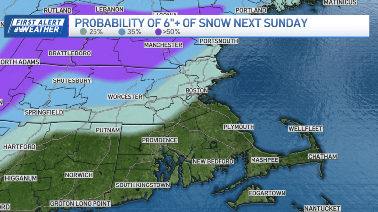
We will experience some cold air over the weekend to prepare us for a larger storm that will pass through the mid-Atlantic and southeast of Nantucket. While the exact path is still unknown yet, the possibility exists, along with abundant cold air. This alone can put us in the 6-12 inch range, favoring locations further away from the coast/headlands.
There is a lot to sort out in the coming days. And BTW, beware of any obscene snow maps posted on social media. There will be a lot of wrangling with the models until they come to a solution later this week, and they always exaggerate the snowfall accumulation in advance.
a happy new year!
A Montana resident woke up to the first major storm of the season, which dumped a foot of snow across the state

