SANTA BARBARA, Calif. – What started out as a mild morning with drizzle and passing rain could turn into a much stronger weather system on the South Coast before the day is over.
The National Weather Service said light rain could become moderate as the system intensifies. This may lead to the possibility of thunderstorms, hail, heavy rain and flooding. The heavy rain will be in an area already saturated with a winter of wet weather. The San Marcos Pass alone has absorbed more than 40 inches of rain.
Some areas, including Gaviota Pass, showed signs of rain-related weakness, with a recent rock and boulder fall resulting in a major vehicle accident.
This storm has marine warnings attached to it but does not pose a threat of damaging coastal surge.
Last week, the berms were created as an environmental amendment for the spring season when the endangered species, the snowy plover, can lay its eggs. Those walls of sand were flattened in Santa Barbara, Carpinteria and Ventura.
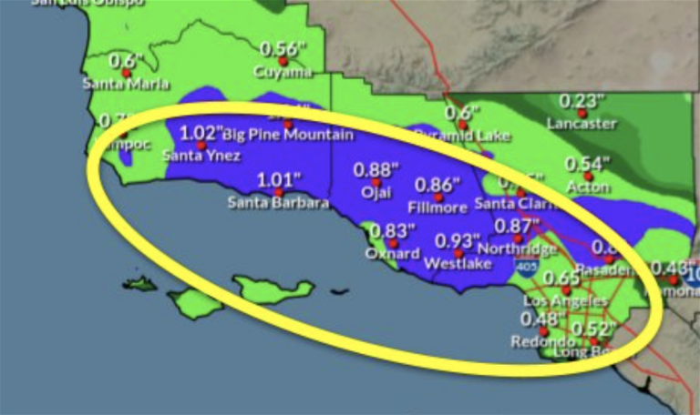
Estimated precipitation totals range from 0.25 to 0.75 inches with local amounts of up to 1-2 inches across the foothills and mountains.
Forecasters said the highest amounts should occur south of Point Conception. Snow levels could locally drop as low as 4,000-4,500 feet early Thursday meaning snow will be visible on the hills behind Ventura and also Mount Figueroa in the Santa Ynez Valley.
Gusty winds are expected to blow from northwest to north across southern Santa Barbara County as the system passes.

