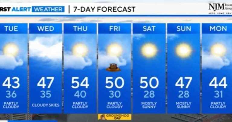
Baltimore The forecast for the next few days looks eerily calm. After an active January, we will enter a period of rain and snow-free conditions across the region with periods of sunshine.
Skies will remain partly cloudy overnight with lows in the 30s. The upper-level disturbance will track southeast toward the region from the Great Lakes overnight into Wednesday morning. This system doesn't have any moisture to contend with, so any rain chances will be limited to areas south and west of the Baltimore area and across western Maryland.
Wednesday will witness continued cloudy conditions with highs in the 40s. The system will be out of the area by Wednesday night. The rest of the week will be pleasant with a mix of sun and clouds Thursday and Friday with highs in the 50s. A cold front will move through the area Friday morning, bringing cold weather with it through the weekend.
The weekend will see more sunshine with highs in the 40s. Overnight lows will drop into the 20s, which is pretty close to where we should be this time of year.
Most of next week looks dry with clouds and sunshine through next Friday with highs in the 40s and 50s. Overnight lows will drop into the 20s and 30s.
The next closest chance of rain/snow will be next weekend before Valentine's Day, when a significant change in the weather pattern is expected. The latter part of February is getting cooler, but there's still plenty of time to see it. Enjoy the mild temperatures until the end.

