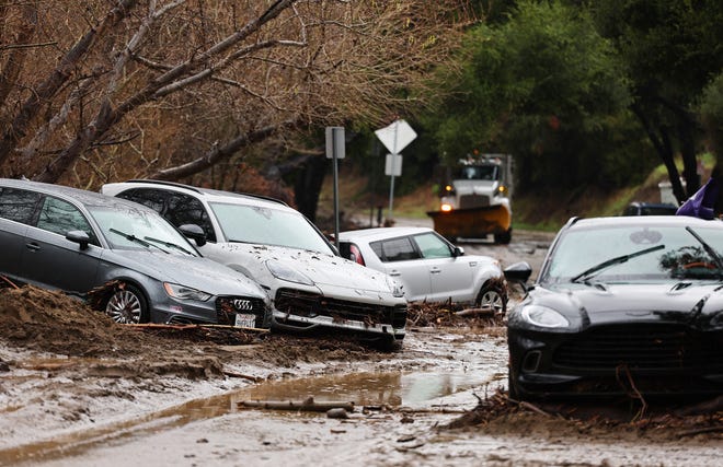
After a brief respite from calm weather, another round of “atmospheric river” storms is expected to hit California over the next few days, bringing heavy rain and snow and raising fears of flooding and mudslides.
“California faces another multi-day siege of stormy weather starting Saturday, which could bring the potential for heavy rain, landslides, heavy mountain snow, strong winds and coastal flooding,” said Linda Lam, a meteorologist at Weather.com.
The storms come about a week after a powerful atmospheric river dumped up to a foot of rain in the Los Angeles area.
This time, northern and central parts of the state could see the worst weather from the first storm over the weekend, while Southern California, including the Los Angeles area, will see the most significant storm on Monday from a second, stronger storm.
“An extension of wet weather will lead to travel disruptions across the state by air and on the ground,” AccuWeather Meteorologist Elizabeth Danko warned.

Snow in the Sierra will be measured in feet
Snow in the Sierra Nevada will come in two parts: the first two storm systems moving in on Saturday followed by a more significant system Sunday night.
Snowfall Saturday night will be measured in inches, but by Sunday it will begin to be counted in feet, said meteorologist Matt Chiba of the National Weather Service in Reno, Nevada, the office that forecasts weather in the high Sierra region.
According to Chiba, Saturday's storm is expected to leave about 6 inches in the mountains. But by Sunday night into Monday morning, snow could start falling at a rate of 2 to 3 inches per hour, leaving up to 3 feet at higher elevations.
AccuWeather said anyone planning to travel through some of the region's mountain passes, including Donner Pass, should prepare for a high risk of restrictions and closures as a result of heavy snow.
The Sierra snow will be great news for ski areas and also for water resource managers, as it will add to what has been below average Sierra snowpack so far this season.
Heavy rain in SoCal may lead to flooding
In the lower elevations of Southern California, fear is primarily related to heavy rain and possible flooding from Sunday's storm. “This system has the potential to bring high-impact weather and flooding concerns to the area through Tuesday evening,” the Los Angeles Weather Service said.
According to the weather service, the storm will bring periods of moderate to heavy rain (2-5 inches and 4-8 inches in some mountains and foothills), strong south to southeast winds, along with the potential for flooding, rockslides and mudslides. And the possibility of power outages.
By Monday and Tuesday, streams and rivers could see strong flows, so campers and hikers should avoid them, said Ryan Kittle, a meteorologist with the Weather Service.
Big waves are also expected from Sunday to Tuesday.
Atmospheric rivers explained
Atmospheric rivers, made visible by clouds, are bands of water vapor that extend thousands of miles from the tropics into the western United States, are 250 to 375 miles wide, and provide fuel for heavy rains and snowstorms that can cause flooding along the West Coast.
In general, atmospheric rivers capture water vapor from warm, moist air in tropical regions and then drop the water to the ground in cold regions as rain or snow.
On average, up to 50% of annual precipitation on the West Coast occurs in a few weather-river events.
more:What is an “atmospheric river”? These rivers of water vapor can extend for thousands of miles.
Contributing: The Ventura County Star; Jeffrey Meehan and Siobhan McAndrew, Reno Gazette

