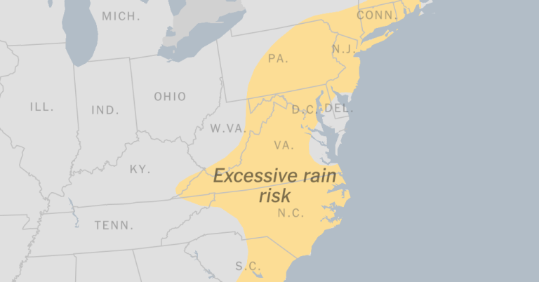
The storm that battered parts of the south with heavy rain on Saturday was expected to reach the northeast, potentially causing coastal flooding and strong winds, forecasters said.
City of Charleston, SC, More than 20 roads closed In the downtown area due to heavy rains and high tides.
Some reports indicated up to 3.5 inches of rain had fallen in the downtown area, said Mark Chenard, a meteorologist with the Weather Prediction Center. An area near the waterfront reported nearly two inches of rain within an hour, he said.
In Isle of Palms, a South Carolina city of 4,300 located about 15 miles east of Charleston, Police posted on social media Residents have been urged to “not drive now if there is absolutely no need to do so” as water levels continue to rise.
A hurricane watch for parts of the Florida Panhandle as well as southeast Georgia has been posted until 2 p.m., Mr. Chenard said. Some of the tornado warnings that were issued have since passed.
High winds in Coffee County, Georgia, on Saturday destroyed the roof of a mobile home and uprooted several trees, said Coffee County Emergency Management Director and Fire Chief Steve Carver. No injuries were reported.
A subtropical jet stream, combined with moist air from the Gulf of Mexico, among other variables, will bring widespread severe weather across much of the eastern United States through Sunday, the National Weather Service said.
Severe thunderstorms as well as hail are possible.
As the storm intensifies, it is expected to move toward the East Coast and reach southern New England by early Sunday morning, the weather service said.
Strong winds and wet snow are expected to blow over northern New England Saturday night into Sunday morning, as lake-related snow sweeps through the lower Great Lakes region through Monday morning.
Snow accumulation of six to 12 inches in New York's Adirondack Mountains will likely begin late Saturday afternoon, Mr. Chenard said.
He added: “Tomorrow will be cold and windy behind the system, and some snow showers will continue.”
The New York City area could receive up to 2 inches of rain through Sunday morning, with the highest totals expected in northeastern New Jersey, meteorologists said. Peak rainfall is expected from 8pm on Saturday until early Sunday.
Mr Chenard said the persistent rain would not last long but would be “briefly heavy”, affecting northern New Jersey, New York City and the Hudson Valley.
Minor to moderate flooding could come with high tide Saturday evening and Sunday morning along western Long Island Sound, Jamaica and western Great South Bay, meteorologists said.
Mr Chenard added that it was possible that snow showers could move through New York City on Sunday evening, although any accumulation was unlikely.
“Expect heavy rain, coastal flooding and strong winds this weekend,” the National Weather Service in New York said. he said on social media. “The potential for strong winds behind the storm will continue into Monday as well.”

