A winter storm headed east over large parts of the Southeast on Monday, bringing more snow and freezing temperatures to the region before reaching the mid-Atlantic and Northeast on Tuesday, where forecasters said it could end a nearly two-year drought without snow. Snow.
The Southeast is bracing for frigid temperatures on Monday, with winter storm warnings and winter weather advisories issued in several states.
The governors of Mississippi and Alabama declared states of emergency as officials across the region opened warming centers and advised residents to prepare for freezing conditions.
Snow, sleet and freezing rain moved into parts of eastern Texas, Arkansas, Louisiana and the Tennessee Valley as the storm moved east. Several inches of snow were expected in Arkansas, the Tennessee Valley and southern Appalachia, the National Weather Service said.
A storm system battering the southern and southern Appalachians is expected to hit the East Coast on Monday, with the initial snow expected overnight before reaching the New York metropolitan area late Tuesday into Wednesday, according to Brian Hurley, a meteorologist with the weather service.
The weather service office in Philadelphia said it expected light snow to fall late Monday and Tuesday, ending a streak of 714 days without an inch or more of snow there.
“Most of the snow will fall Monday night, and it will be light and fluffy snow,” the office said on Facebook, adding that the snow could turn to a “wintry mix or rain” before ending late Tuesday.
The streak of 701 days without an inch or more of snow could also end in New York City. The New York Weather Service said in its forecast that between one and three inches of snow were likely on Tuesday.
“For a lot of these larger cities, we're not seeing anything above two to four inches in this particular system,” Hurley said, referring to the snowfall totals expected in the Northeast. He added that forecasters will monitor the system late in the week on Friday.
“By then, if it stays closer to the coast, that could give us more snow here in the Northeast,” he said.
On Monday, New York City is expected to reach highs in the lower 30s during the day and lows in the upper 20s, the weather service said, adding that there is a 60 percent chance of snow.
A different system also caused temperatures to dip below zero in the Plains and parts of the Midwest, and “near-record and dangerously low” temperatures could persist in parts of the Midwest, meteorologists said.
Iowa Republicans are likely to face record low temperatures before the Iowa caucuses on Monday night.
Heavy lake effect snow was expected to continue to cover parts of northern Michigan and northern and western New York State, including the city of Buffalo, where a winter storm warning was in effect until early Monday morning.
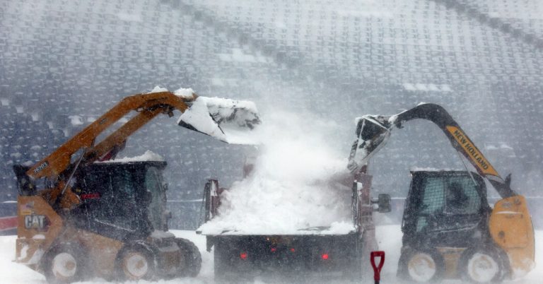
High winds and snow over the weekend caused the NFL to postpone a playoff game hosted by the Buffalo Bills until Monday afternoon. Residents said the storm paled in comparison to the deadly snowstorm that hit the Buffalo area in late 2022, and added that advance warnings gave them enough time to prepare.
“You're given more notice of what's going on,” said Lisa Fuentes, who works for the city of Tonawanda, just north of Buffalo. This wasn't the case before the blizzard of 2022, when I ran to the store for last-minute supplies. “I could barely get home from the store before the situation got really bad.”
Paul Lin Contributed to reports.

