Intermittent showers and warmer weather ahead
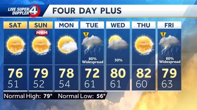
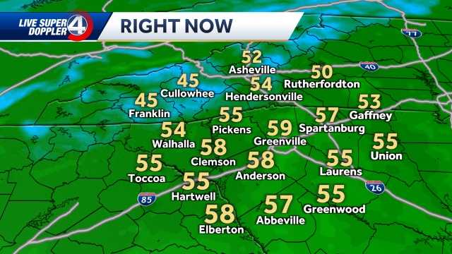
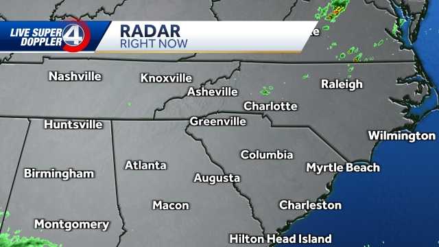
The weekend is a lot quieter than we were yesterday. GSP. We caught about 2.25 inches of rain throughout the day. Yesterday was one of those days where I wanted to stay inside as it was cold. It was raining and that was the theme all day Friday. The good news now is that we've dried things out. All that moisture has since moved out to the east and northeast, and we're only left with a few residual showers throughout the first part of the day. The clouds will be confined, so it will be difficult to break through that cloud cover, but you will notice that our temperatures will be rising. We topped out in the 40s yesterday afternoon. Today we will jump about 20 degrees. Most of us will reach our mid-60s. Some spots, upper 60s with a little breeze starting to develop. Now this warm trend will continue with us. We go from fairly close to average temperatures today, jump into the upper 60s tomorrow, and still push 70 degrees early next week. So we'll start to see temperatures rise well above average. It's been a bit of a rollercoaster over the past few days. We'll continue to hold that in check as we move into the rest of this weekend and into early next week. Now, as far as our rain chances go today, they're pretty isolated. Again, some spotty rain is possible, but once we get into the late morning and afternoon, most of that moisture should dissipate. I expect we will see mainly dry conditions throughout the day. today. However, it will come with more cloud cover, so we may be able to see a break or two of sunshine late in the day. But it will take some time for this cloud cover to finally be complete tomorrow. It looks like we may have a better chance of seeing more sunshine and warm temperatures. So I would say Sunday would be my favorite day of the weekend. Now, as for our next chance for more widespread rainfall, things will clear up this afternoon. Then Sunday and Monday look basically dry now as we track that chance for more widespread rain to arrive in the second half of Tuesday. Especially moving to Wednesday. So, we'll start out on a dry Tuesday, and then moisture will come knocking on our door late Tuesday, becoming more widespread and potentially heavy at times as we work through the mid to late week. So, we have an impact day coming up on Wednesday due to another round of very good widespread rain chances, and it looks like the unsettled weather is going to stick around. But for now, we're just looking at a few sporadic sprinkles. The first part of today's liquidation is this afternoon with the highs in less than 60 seconds. Sunday: Partly cloudy skies, with a high around 70 degrees. Sunday, Monday, Tuesday of next week, and then we're looking at unsettled weather coming back into the forecast late Tuesday, continuing into Wednesday, and then yes, we'll still see some rain in the forecast.
Intermittent showers and warmer weather ahead
Intermittent rain and warmer weather this weekend. Sydney Sullivan offers an inside look at what lies ahead in your forecast. Watch your full predictions in the video above. Track rain and storms on the interactive radar here Check the latest alerts in your area here Watch live sky cameras from across the Carolinas here Get hour-by-hour and expanded forecasts here
Intermittent rain and warmer weather this weekend. Sidney Sullivan offers an inside look at what lies ahead in your forecast.
Watch your full predictions in the video above.
- Track rain and storms on the interactive radar here
- Check the latest alerts in your area here
- Watch live Skycams from around the Carolinas here
- Get your hour-by-hour forecasts and extended forecasts here


