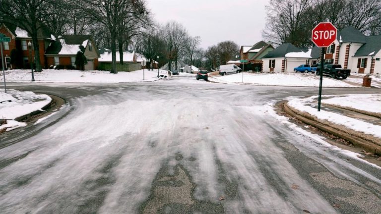
Ice storm warnings were issued in Oklahoma, Arkansas and Missouri.
Ten states from Arkansas to Pennsylvania are on alert for snow, freezing rain and sleet as the latest dangerous winter storm moves across the United States.
Ice storm warnings are in effect for Oklahoma, Arkansas and Missouri. The warnings are expected to end later in the day as the snow turns to rain.
Monday afternoon, Texas faces heavy rain while the region from St. Louis to Chicago deals with a coating of icy roads.
By Tuesday morning, rain and snow will move into the Great Lakes region and the Ohio Valley.
By morning, the snow will mostly turn to rain from Chicago to Detroit, but a smooth morning commute is still expected.
On Tuesday afternoon and evening, snow will extend from Michigan to upstate New York to New England. A few inches of snow is possible.
After the ice storm ends, the south of the country is expected to be hit by rounds of heavy rain this week, with some areas expected to see more than a foot of rain. Flooding is possible from Texas to Georgia.
Meanwhile, heavy rain is falling on the West Coast.
A flood watch is in effect for Sacramento in Northern California and San Diego in Southern California. Rainfall rates can reach a half-inch per hour in San Diego.
The San Diego Fire Department said it conducted about 15 rescues on Monday. On Monday night, San Diego Mayor Todd Gloria declared a state of emergency “due to heavy rainfall and flash flooding,” he wrote in a post on X.
Winter storm warnings have been issued for the Sierra Nevada mountain range, where more than a foot of snow is possible. Some areas around Lake Tahoe are also under an avalanche warning.
Temperatures are expected to rise later in the week in the Midwest, Northeast and Southeast.
Temperatures can exceed 50 degrees in New York City, 80 degrees in Tampa, Florida, and 60 degrees in Memphis, Tennessee.

