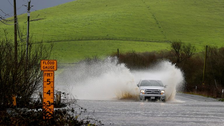
The westbound lanes of the Pacific Coast Highway were closed due to a mudslide in Santa Monica, while large boulders blocked both lanes at the intersection of Malibu Canyon Road and Piuma Road in Agoura Hills. Flooding also closed the HOV lane and the second lane on Interstate 5 in Burbank for some time late Monday morning.
The worst affected areas appear to be between Los Angeles and San Luis Obispo. Montecito reported 8.84 inches of rain, with 9.71 inches a few miles to the northeast in the mountains near Toro Canyon Creek. Most of Ventura County's mountains received at least 6 inches of rain, including 5 inches just north of Malibu and 4.36 inches at Pepperdine University. Downtown Los Angeles saw much less rain, but more is on the way. It has already received 11.64 inches of rain this month, the fifth-most on record; If another two inches fall, it will be the wettest February on record.
In Southern California, there is a risk of an isolated tornado or plume, after several tornado warnings in the Sacramento Valley on Monday. At least one of the storms that sparked tornado warnings raced into the mountains and dumped snow.
High winds in the central and northern parts of the state toppled trees and power lines. While strong winds eased, more than 10,000 customers remained without power Tuesday.
The influence of the atmospheric river is expected to finally diminish by Wednesday evening, but the active weather looks set to return in time for the weekend.
Where is the atmospheric river located now?
An atmospheric river — strands of deep tropical moisture coming from near Hawaii — is pushed ashore by low pressure centered off Oregon. It has made its way up the coast and is now targeting Southern California. San Diego and Los Angeles are within range of the moisture column, and will be all day Tuesday.
Behind it, a pocket of cold air moves high above in combination with a low-pressure core at the upper level. This will bring scattered heavy rain and possibly some thunderstorms across much of California through Wednesday evening.
A few of those thunderstorms could produce small hailstones, an isolated funnel cloud, or even a rogue tornado.
A risk level of 3 out of 4 for flash flooding and heavy rain has been assigned to the Los Angeles metro area. “Individual rain showers and any consolidated storms will move very quickly,” the National Weather Service wrote, but “the train will be stationary,” meaning heavy rains will continually move over the same areas as train cars on the track.
Another 2 to 4 inches of rain is likely in the mountains north of Los Angeles, while downtown areas will see closer to an inch, or perhaps more if it does rain.
The problem with this storm is not the rainfall totals — which will be significantly lower than in the previous storm, which dropped more than 7 inches of rain in two days. Instead, the concern is about rainfall rates Topping out half an inch per hour. This will quickly overwhelm the already saturated soil and ground, leading to additional flooding.
Meanwhile, precipitation has largely ended in central and northern California, with only isolated rain falling over the next 36 hours.
Heavy snow and strong winds
Snow levels in the Sierra Nevada will drop from 7,000 feet to about 6,000 feet, resulting in greater accumulations at higher elevations. A few more inches are likely above 6,000 feet at resort levels, but the high Sierra peaks could see another 2 to 4 feet of snow.
As of Monday, several areas in the Sierra had received double-digit totals, including Northstar, Bear Valley, John Lake, Kirkwood and Mammoth Mountain.
Wind speeds along the Sierra could also reach more than 40 mph, but elsewhere the strong winds have largely subsided. At the Central Sierra Ice Laboratory in Donner Pass, run by the University of California, Berkeley, High winds cut power on Monday. Several winds reached 60 mph in the Sierra, including a 99 mph gust near Mammoth Mountain.
In the mountains of Southern California, the National Weather Service forecast 10 to 20 inches of new snow, with snow levels falling from 7,500 to 6,000 feet.
By Thursday, the original upper air turbulence is expected to exit behind this atmospheric river. After that, the weather is expected to be calm before the next atmospheric river arrives late Sunday.
Jason Samino contributed to this report.

