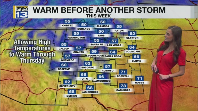
It was the last Sunday of January in New Mexico, with lots of sunshine, slightly above average temperatures, and calm conditions. Temperatures will continue to gradually rise each day this week as a series of high pressure builds over the state. High clouds will move across the state tomorrow, with denser cloud coverage arriving Tuesday/Wednesday.
A very weak disturbance will push north from the Baja Peninsula on Tuesday. This will increase moisture in far southern New Mexico, bringing more cloud coverage through Wednesday. Isolated light drizzle cannot be ruled out but high pressure will keep the state dry for most of the week. Temperatures will warm up through the day Thursday with the 70s returning to southern New Mexico and the 60s and 50s north.
By Friday, the next big weather maker will approach the state. This will bring widespread high-elevation snow and low-elevation rain across the state. The storm will also bring temperatures down, bringing low snow levels into Saturday morning. This could bring snow to the Albuquerque metro and create some rough travel this weekend. The exact intensity, timing and location of heavy rainfall remains uncertain. Get outside and enjoy a glimpse of spring this week before the cold, wet weather arrives next weekend.

