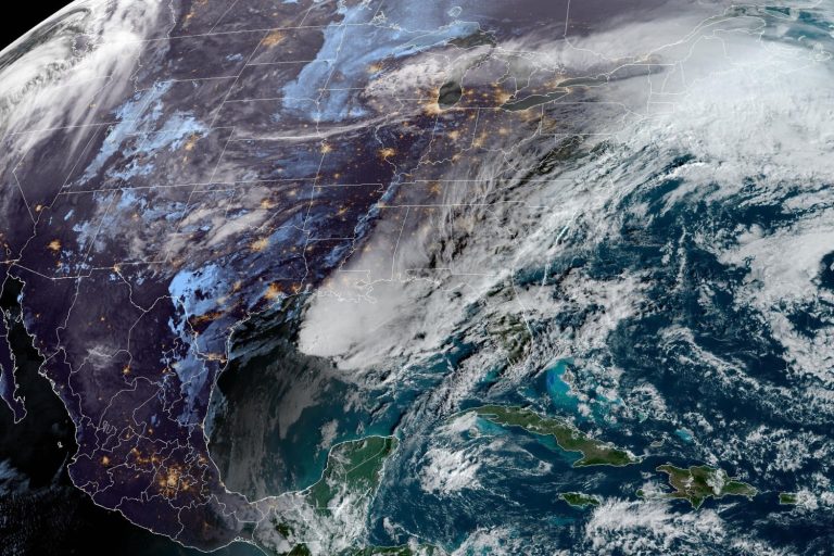
Two separate storm systems will impact the eastern half of the country on Friday and over the weekend.
On Friday, rain will continue from the Midwest to the Northeast as the first storm on the map moves slowly through these areas.
For places like New York City, this will extend a dismal period of cloudy, rainy days during which the sun has not shined for five days, since Monday afternoon.
While all the rain is expected to fall on the Interstate 95 corridor, freezing rain and snow will fall on northern parts of New England through Friday night. This system heads off the coast by the evening hours, leaving behind stray snow showers headed for New England.
Across the South, the next storm system will form from the southern Plains to the Gulf Coast, bringing the next wave of rain and storms to those areas this weekend.
On Saturday, rainfall will increase in speed, coverage and intensity throughout the day. The result will be more rain in the already saturated Southeast and Gulf Coast states. These heavy rains will create localized areas of flash flooding, especially in urban areas and saturated roads, rivers and streams.
There will also be a severe weather risk Saturday in the Southeast, with the Alabama cities of Birmingham, Montgomery and Mobile in the highest risk area. New Orleans and Atlanta are cities that could also see an isolated strong storm. Damaging wind gusts, some tornadoes and hail will be possible.
By Sunday, the storm system is moving away from the East Coast, flooding the I-95 corridor from Washington, D.C., to Boston. Rain changes to snow and ice in the interior Northeast and along the Appalachian Mountains Sunday night into Monday morning.
The largest rainfall totals for this system will be along the Gulf Coast, where New Orleans could see 2 inches of rain through Sunday. Cities like Washington; Richmond, Virginia; Knoxville, Tennessee; and Birmingham, Alabama, could all see totals greater than one inch.
Although the precipitation totals won't set records in this case, it will add to the group of cities already experiencing a wetter-than-average January.
Many cities in the corridor stretching from Texas to the Northeast saw more than double their average January precipitation, with several locations in the Mid-Atlantic and Northeast recording the top 10 wettest Januarys on record.
Maximum snowfall totals will be around 3 inches, with the greatest snowfall totals in the interior Northeast.
One reason this series of storms is wetter than winter is due to the spring temperatures that dominated this week.
All week, temperatures were 10 to 30 degrees Fahrenheit above average making it feel more like March and April for cities like Cleveland, Richmond, Boston and Atlantic City, New Jersey.
This has already been one of the five warmest winters on record in cities like Minneapolis, Detroit, Buffalo, New York and Worcester, Massachusetts, where warm winter temperatures are expected to continue into February.

