A Pacific storm barrage is preparing to drift toward the United States, threatening flooding by unleashing a half-foot “wave” of freezing rain.
California will bear the brunt of a “series of storms” expected this week, although much of America's South and Southwest faces flooding.
Meteorologists warn that with up to half a foot of rain falling on the most affected areas, heavy snow will cover the hills and mountains.
Plunging temperatures across the Midwest will bring the risk of freezing rain, turning roads into deadly icy rinks.

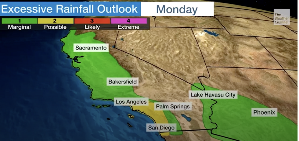
California will bear the brunt of a 'series of storms'
Weather channel
“There will be heavy rain in parts of the south next week, especially during the middle of next week,” said Ari Sarsalari, a meteorologist at The Weather Channel.
“This is a storm system that will drop some freezing rain and some icy conditions in parts of the Ozarks and the Midwest.
“We also have some snow in the northern tier, but if you live in the south it will just be rain.
“It's a slow movement from west to east over the next few days.”
He warned that rising temperatures would lead to the melting of snow piles, which, along with heavy rains and thunder, would lead to the risk of flooding.
“We will have some thunder, and with the heavy rain, flooding will be a problem especially during the first to mid-part of the week,” he said.
The latest developments:

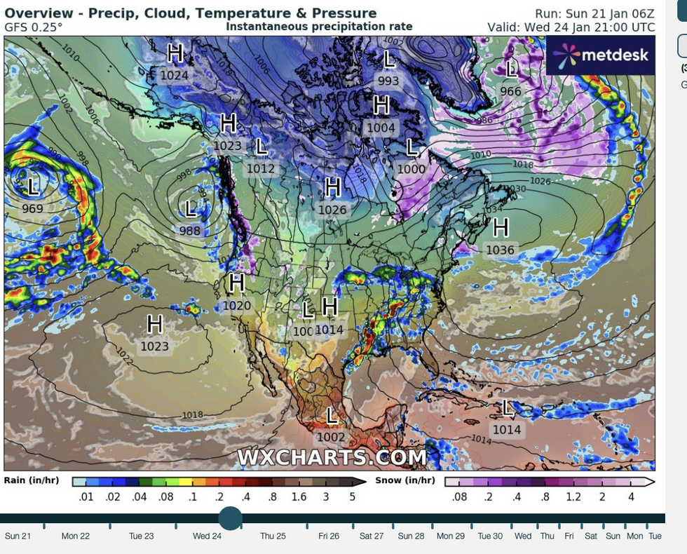
A pulse of warm air arriving as the U.S. grapples with a near-historic deep freeze will bring a deluge of freezing rain
WX charts
“There is a lot of moisture that will flow to the West Coast and we will also see snowmelt, but there will also be snowfall in the higher terrain in the Sierra.
“Almost all of California will be under the pressure of very good rain and on Monday, the heaviest rain will shift to the south.”
Weather models show about seven low-pressure storm systems lined up to hit the West Coast before the end of the month.
The powerful jet stream from the Pacific Ocean will become a conveyor belt that directs storms toward the West Coast.
In the east, the collision of air masses will lead to the risk of more heavy snow falling on the Great Lakes and surrounding areas.
A pulse of warm air arriving as the U.S. grapples with a near-historic deep freeze will bring a deluge of freezing rain.
The US National Weather Service (NOAA) has warned that “multiple” storm systems will attack across western America.
“Along the West Coast, multiple frontal systems coming in from the Pacific will bring more active weather ashore over the next couple of days,” a hurricane spokesperson said.
“Heavy rain is likely to continue across Northern California today, followed by a brief lull this evening before the next wave of heavy rain is expected to arrive on Monday.
“Meanwhile, heavy, wet snow is expected along the Sierra Nevada during a similar time frame.
“In addition, the flow of warm air overcoming cold air trapped near the ground will continue to bring the potential for icy or freezing rain over the Columbia Gorge over the next couple of days.”

