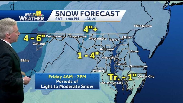
A great shirt to match your coat or coat. Lots of layers underneath. Yes. We're talking about wind chills. This will drop to around ten figures as the game goes on. So the wind, cold and snow will disappear. But the cold will set in during Saturday's game in the afternoon and evening. This wind comes at 20 and sometimes reaches 30. So the wind cools down at the start of the match around 10 o'clock. It will be dry at kickoff and then drop a little, perhaps into the low 20s, perhaps near 20 degrees. By the time the game is over. These winds will remain active throughout the afternoon and evening. So the wind chill will again drop into the single digits. You have to prepare for the cold. Last time we had a really cold match like this at MT. It was Bank Stadium on Christmas Eve. I think it was 2022 or so. So, that was pretty cool. This one probably won't be quite as cool as that one, but it will still hold up if you're headed to the game. These are the current temperatures across the region. Notice the warmer air here in the South in the upper 30s and low 40s. This area will see less snow tomorrow than areas north of the Bay Bridge leading to Baltimore. We finally made it above freezing for the first time since Sunday afternoon. We've had three and a half or more days of freezing temperatures across our area. Even western Maryland is now at 25 degrees, with winter weather warnings indicating higher amounts of snow. Consultations are lower amounts. We are in the advisory area, which will carry us through the day tomorrow. If you reach northern Delaware, southeastern Pennsylvania, you could get an additional round of snow. So they are on warning. In western Maryland, snow will continue to fall from Friday night into Saturday. They are under warnings there. But from this blue-shaded area, widespread snowfall of 1 to 4 inches is expected starting tomorrow morning. Now, we do have some snow on radar, but most of it is just in the clouds and doesn't reach the ground. A wave or two could move through our area this evening. This is an atmospheric disturbance in the upper atmosphere that will pass close to us. The main branch of the storm system will then come in and track through southern Virginia near the North Carolina border on Friday. This system, as you can see coming from here, doesn't really have a significant amount of moisture associated with it. Maybe a little Gulf moisture will feed into it, but it's a fairly dry system overall. This will reduce the amount of snow we have. But it will be very cold. Once the system passes this next batch of Arctic air, it will come up for filtering. And that's what we're going to have to deal with for that. Ravens game. So, in the future broadcast, you see some light snow spreading across central Maryland. 4:00 AM. I think the heaviest batch of snow will likely be mid-morning to early afternoon. Just an estimate, say nine, 10:00 a.m. to 1 or 2 p.m. We will witness moderate snow flurries that may be heavy at times. Since it has been so cold for a long time now, the ground is completely frozen. This means that all of this will largely continue as the snow falls during the middle part of the day, and the winds should start to pick up between 6 and 7 on the western Gulf and between 7 or 8 on the eastern shore. I think by 10:00 it will all be over. But this is the time when the cold comes and the wind starts to pick up. It will be in the teens on Saturday morning and only in the mid-20s in the afternoon, again setting the stage for a very cold Ravens game. So the forecast tonight will be cloudy and cold snow after 4:00 AM. Temperatures drop back into the low to mid 20s during the day. Tomorrow, snow is likely to be heavy at times during the middle part of the day and then subside in the evening. High temperatures are 28 to 32 degrees. A snow day across the state tomorrow, except in southern Maryland, where some rain and sleet will mix with temperatures there above freezing. But for our area, 1 to 4 inches in that area where you get a mix, any trace of an inch is possible and even near the Pennsylvania line, or in the cooler northern areas in Carroll, Frederick County, you can exceed the four-inch mark. I wouldn't be surprised if we get a report of 4 or 5 inches of snow. there. If it comes down at a very good clip in the afternoon, the mountains will get a nice fresh layer of snow for the ski slopes there, 4 to 6 inches of snow tomorrow with more on the way in the mountains on Saturday. Look at those eight degrees for the high temperature in McHenry on Saturday, 20 degrees here. At least we'll get some sunshine on Saturday, but it will be windy and cold if you don't like wintry weather, the next two impact days so look down the road in the seven day forecast. We have rain coming next weekend A
WEATHER IMPACT: A winter weather advisory is in effect Friday due to snowfall in Maryland
It will be stable snow with temperatures at or below freezing, so it will stick
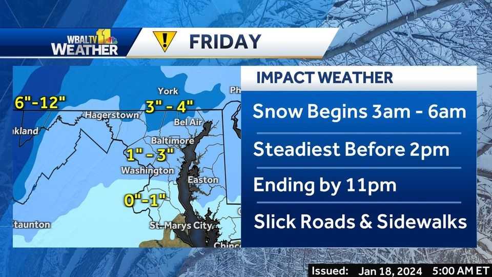
The National Weather Service has issued a winter weather advisory starting early Friday with snow expected to fall throughout the day.|| Closures/Delays | Weather Alerts | radar | Forecast | Email Alerts | Send us your photos || After about 716 days without snow, Maryland is getting its share this week. After snowfall on Tuesday, more snow is expected on Friday. Light snow may begin to fall overnight, around 3-6 a.m., with heavier snow falling later in the morning by rush hour. Light to moderate snow will continue throughout the day. The storm system carries little moisture, and dry conditions may reduce snow amounts. But because the ground has been so cold for so long, snow will continue to fall. The snowfall is expected to subside by early evening, but the winds will begin to increase and will continue until Saturday.| Link: SHA Statewide Transportation Response Map | Winter Weather Guide Accumulation forecast ranges from 1 to 4 inches for most of central Maryland, which is of course subject to change based on the improving storm track. Areas with higher elevations, especially in North Carroll County, for example, could see more snow. Tuesday's snow totals were mostly about 4 to 5 inches on the upper end, averaging about 2 to 3 inches elsewhere. Then, on Saturday afternoon of the Ravens' playoff game, it's another day of impact weather with temperatures in the 20s coupled with 15-20 mph winds, and higher gusts. Wind chill temperatures (what it will feel like) will be around 10 degrees. Download the WBAL-TV app now and turn on alerts to be aware of severe weather warnings, listen to NOAA Weather Radio, and watch WBAL-TV 11 when severe weather is imminent to develop.@wbaltv11 | @TTasselWBAL | @AvaWBAL | @TonyPannWBAL | @DalenciaWBAL | @ChelseaWeather Share your weather photos and videos Show us your weather photos and videos, and we might use them in 11 News or online! Direct Upload: Use this form to upload photos or videos. EMAIL: Simply email photos and videos to news@wbaltv.com Recent weather video below: Snow line breaking, more to come. WBAL-TV 11 Maryland Weather RadarApp users click here for interactive radar. Maryland 7 Day Weather Forecast, Alert Days vs Impact Days You may see the WBAL-TV 11 weather team highlighting Alert Days or Impact Days in the forecast. Here's what that means: An impact day is when the weather is likely to disrupt your daily schedule or routine. A day of alert is when there is a threat of extreme, severe and potentially life-threatening weather. Potential Power Outages Baltimore Gas & Electric has scheduled 100 additional outages for contractor crews to ensure resources are available for the duration of the expected weather. Customers are encouraged to prepare in advance, and report power outages if they occur. Stormy conditions can cause power outages by tree branches falling on power lines and other electrical delivery equipment. BGE asks all customers to report outages in any of the following ways: Online, on the free mobile app BGE.comBGE, available on the Apple Store or Google Play, by text to phone 69243, by calling 877-778-2222latest Outage information, including total numbers and general locations, is available on the BGE.com outage map. As a reminder, you should never approach or touch fallen overhead power lines even if the lines do not appear to be live or on fire. Call BGE at 877-778-2222 to report downed electrical lines, power outages and gas odors. ALERTS: Severe weather alerts from the WBAL-TV app: A step-by-step guide CLOSINGS: Find out if schools, businesses or organizations have closed or delayed RADAR: Track snow, sleet or freezing rain with WBAL-TV's interactive radar METHODS: Check Breakdowns and backups with our interactive traffic map Winter: Guide: Snow safety, driving hazards, and power outages
The National Meteorological Directorate issued a Winter weather warning It starts early Friday with snow expected to fall throughout the day.
|| Closures/Delays | Weather Alerts | radar | Forecast | Email Alerts | Send us your photos ||
After about 716 days without snow, Maryland is getting its share this week. After snow fell on Tuesday, more is expected on Friday.
Light snow can begin to fall overnight, around 3-6 a.m., with more consistent snow falling later in the morning by rush hour. Light to moderate snow will continue to fall throughout the day.
The storm system contains little moisture, and dry conditions may reduce snow amounts. But because the ground has been so cold for so long, the snow will stick.
Snowfall is expected to subside by early evening, but winds will begin to increase and will continue through Saturday.
| connection: SHA statewide relocation response map | Winter weather guide
Accumulation forecast ranges from 1 to 4 inches across much of central Maryland, which is of course subject to change based on the improving storm track. Areas with higher elevation, especially in North Carroll County, for example, could see more snow.
Tuesday's snow total was about 4 to 5 inches at the upper end, averaging about 2 to 3 inches elsewhere.
Then, Saturday afternoon for the Ravens' playoff game, it's another day of impact weather with temperatures in the 20s coupled with 15-20 mph winds, and higher gusts. Wind chill temperatures (what will Feel Like) it will be about 10 degrees.
This content is imported from Twitter. You may be able to find the same content in another format, or you may be able to find more information, at their web site.
Download the WBAL-TV app now and Turn on payment alerts To be aware of severe weather warnings, listen to NOAA Weather Radio, and watch WBAL-TV 11 when impending severe weather develops.
@wbaltv11 | @TTasselWBAL | @AvaWBAL | @TonyPannWBAL | @DalenciaWBAL | @ChelseaWeather
Share your weather photos and videos
Show us your weather photos and videos, and we may use them on 11 News or online!
Recent weather video below: Snow has fallen, and more is coming
WBAL-TV 11 Maryland Weather Radar
App users click here for an interactive radar.
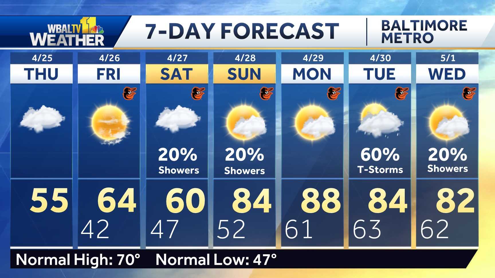
7-day weather forecast for Maryland
Days of alert versus days of influence
You may see the WBAL-TV 11 weather team highlighting alert days or impact days in the forecast. Here's what that means:
- An impact day is when the weather is likely to disrupt your daily schedule or routine.
- A day of alert is when there is a threat of severe, potentially life-threatening weather.
Possible power outage
Baltimore Gas & Electric has hired an additional 100 contractor crews to ensure resources are available for the duration of the forecast weather. Customers are encouraged to prepare in advance, and report service outages if they occur.
Storm conditions can cause power outages by tree limbs falling on power lines and other electrical equipment. BGE asks all customers to report service outages in any of the following ways:
The latest outage information, including total numbers and general locations, is available on the BGE.com outage map.
As a reminder, you should never approach or touch fallen overhead power lines even if the lines do not appear to be energized or on fire. Call BGE at 877-778-2222 to report downed electrical lines, power outages and gas odors.


