A duo of deadly storms launch a two-sided assault on America, unleashing a brutal winter deluge across both the East and West coasts.
Storm Indigo threatens with up to 2 feet of snow and thick ice as it reaches Western states, while the Northeast reels in the wake of Storm Heather.

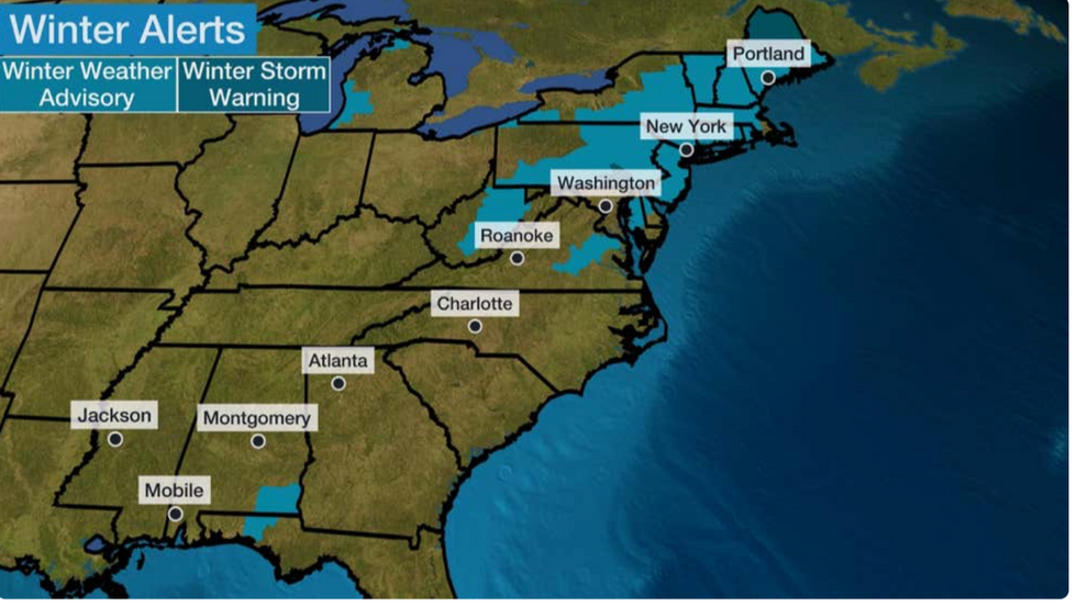
East Coast areas are on winter storm alert
Weather channel
The crippling winter storm shows no signs of abating, with forecasters warning it will continue through the weekend.
“Large amounts of snow are expected, and in parts of northern New England we could see up to eight inches,” said Dominica Davis, a weather channel meteorologist.
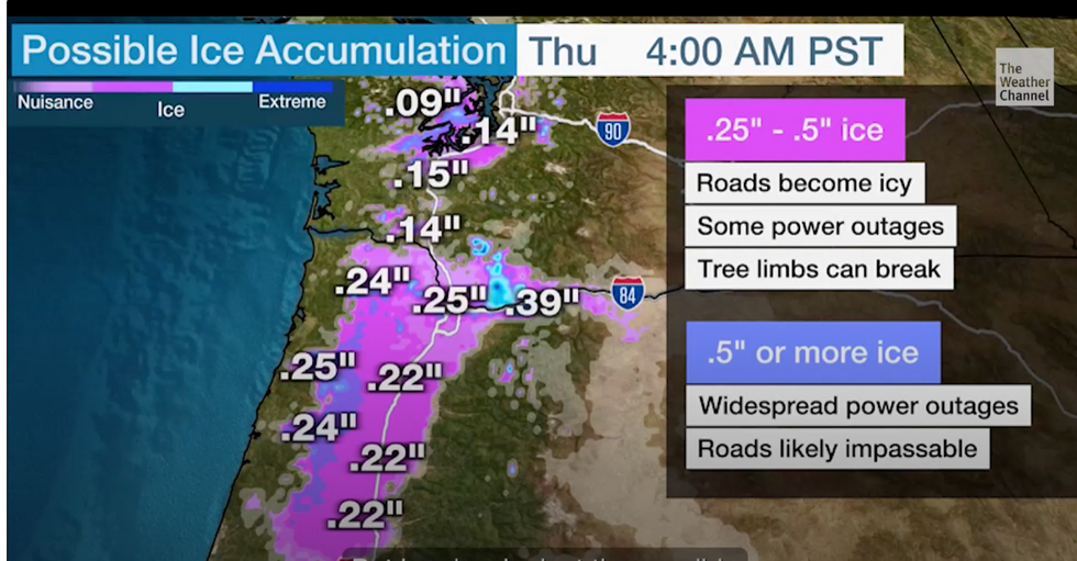
“The next winter storm is heading our way and this is Winter Storm Indigo, ice and heavy snow will be big threats with that, especially ice.”
Rain-soaked highways frozen over and turned into ice skating rinks have prompted warnings for people to be careful or avoid travel altogether.
Latest in the United States:
Eastern coastal areas were warned to prepare for power outages and tree limbs toppled by half-inch ice sheets.
“This is going to be big with a lot of ice potential,” Ms Davis said.
“Moving inland, that's where the heaviest snowfall is, so even through the middle and late week, we'll still be dealing with this wintry weather system.
“It's important, and there are very dangerous things on the way.”

Snow storm warning
Weather channel
Storm Heather moved up the East Coast over the weekend, unleashing inches of snow and causing chaos on roads and highways.
Freezing rain and sleet left cars miles long, while leaving cars “strewn all over the roads,” according to the Weather Channel.
The National Weather Service (NOAA) issued more winter weather warnings with Oregon and parts of southwest Washington at risk of ice storms.
The winter deluge will be exacerbated by thunderstorms and 'dangerous' cold winds as the Arctic blast 'hit' the US.
Low pressure from the Pacific Ocean will collide with the frozen air mass, creating a deluge of freezing rain.
Although temperatures will warm up a bit around midweek, the respite will be short-lived with another icy drop expected before the weekend.
“Dangerous wind chills and record cold temperatures continue in the middle of our nation,” a NOAA spokesperson said.
Meanwhile, snow will accumulate across the eastern Great Lakes region and northeastern corridors.
“More lake effect snow is expected downwind in the Great Lakes region through midweek. Isolated severe thunderstorms are possible in Central Florida.
“Winter storms are coming this week, and there will be more big snow events in parts of the country,” said Jim Dale, an American weather correspondent and meteorologist with the British Meteorological Service.
“Cold air is present throughout the United States, so the problem will be when low pressure brings in milder air that contains moisture.
“This will bring significant amounts of snow, and we are looking at one of the most severe winter storms in the United States.”

