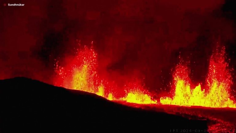
Images of Sunday's eruption, taken from a Coast Guard helicopter and shared by Icelandic police officials, showed lava flowing over the ground and lighting up the night sky, reaching the perimeter of roads and buildings. About an hour after the eruption began, lava reached within 1,500 feet of buildings in Grindavik's northernmost reaches, officials said.
In an interview with national radio RUV, seismologist Kristin Jónsdóttir estimated that it would take hours for the lava to reach the city if it continued to flow in the same path. “What matters is where the lava flows. It is now very important to monitor it,” she said.
Officials estimated the location of the eruption to be southeast of Hagafell, and said evacuations in the area were underway.
According to the Meteorological Office, earthquakes shook the area starting around 3 a.m. Sunday. Officials said the level of seismic activity was similar to what was recorded before the Dec. 18 eruption, although Sunday's tremors were farther south.
Iceland's Civil Protection Agency said that police began evacuating Grindavik residents at 4 a.m., after authorities detected earthquakes and concluded that an eruption may be imminent. Authorities said holidaymakers in the nearby Svartsingi area, where Iceland's famous Blue Lagoon is located, were evacuated.
On Sunday morning, Iceland raised its public safety alert level from “danger” to “emergency.”

