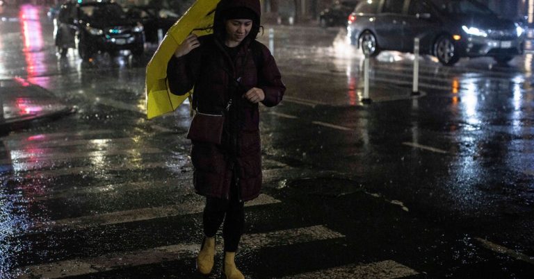
Much of the United States was continuing to struggle Wednesday with a mixed bag of unstable weather — snow, rain, strong winds, flooding and freezing temperatures — that upended daily life for millions of people from coast to coast.
Some pockets of the United States saw improved conditions, while other areas faced rain, wind and snow again.
Flood warnings are expected to remain in effect along many rivers up and down the East Coast where hundreds of streams and rivers were at flood stage.
High winds and possible flooding in New York.
Although heavy rain exited the area early in the day, the storm left more than 110,000 customers in New York state without power as of 1 p.m., and nearly 50,000 customers were without power in New Jersey, according to Poweroutage. us, which tracks utility information. Meteorologists with the National Weather Service remain concerned About the lingering winds.
Forecasters said wind gusts of up to 50 mph could be felt in southeastern New York, southern Connecticut and northern New Jersey. Gusty winds can topple tree limbs and blow down trees and power lines.
The Weather Service has issued a flash flood warning for New London County, Connecticut, until 6:45 p.m., due to a partial dam failure on the Yantic River. City of Norwich An evacuation order was issued for areas along the river due to dam conditions.
More rain in parts of Maine.
All eyes were on the effects of rain in the Northeast once again. Flood watches and warnings were issued for parts of New England and the mid-Atlantic region on Wednesday.
Coastal flooding on the northern coast of Massachusetts and parts of New Hampshire made some roads impassable, officials said.
There was a slight risk of heavy rain across southern parts of Maine, with up to three inches of rain falling over saturated ground, as well as swollen creeks and streams, increasing the potential for flooding in the area.
And if the rain isn't enough, wind is expected to be a factor as well. Winds of more than 50 mph are expected across the region, especially near the coast and higher areas.
In the Atlanta area, temperatures are expected to rise into the mid to upper 40s with some sun. Temperatures are expected to rise slightly in areas far south of the city.
Similar calm weather also settled over the Birmingham area. Meteorologists told area residents on Wednesday It will be a day to “catch your breath” Enjoy the calmer weather. But storms could return to the area by Friday.
Calmer conditions are also expected in the Florida Panhandle. However, flood warnings remained in effect for several rivers, including portions of the Ocilla River affecting Jefferson, Madison and Taylor counties.
Some rain persisted in the Midwest, but temperatures were dropping.
As the snow began to taper off overnight, falling snow and gusty winds were expected to create pockets of soft travel around the Chicago area Wednesday evening. Meteorologists said.
Likewise, in Columbus, Ohio, cold air was expected to turn remaining rain into snow. A wind advisory remained in effect for parts of Ohio until 4 p.m
In Minneapolis, Another inch of snow It is expected Wednesday afternoon and evening. However, meteorologists warned that the harshest winter temperatures will settle into the region on Friday, bringing sub-zero temperatures and dangerous wind chills.
Snow, snow and more snow for the West.
Just like Tuesday, the weather pattern over the western United States on Wednesday was brisk, bringing another heavy snowfall to the Cascades and Sierra Nevada regions.
The disturbance is then expected to move southeast across the desert southwest, bringing valley rain and mountain snow across Arizona and New Mexico, through Thursday.
For the northern plains, the focus will be on Mercury's decline. A strong polar front moving south from Canada will bring the coldest temperatures so far this season. It will be a precursor to a storm that will intensify through the day Friday, bringing another round of blizzard conditions, severe storm conditions, widespread winds and rain to roughly the same areas affected in this previous storm.

